Wayfinding for Milwaukee County’s Oak Leaf Trail System
Milwaukee, WI
Project Summary
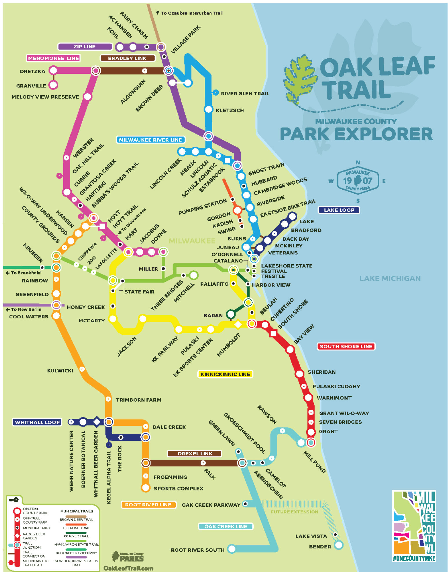
Toole Design developed two wayfinding Bike Walk Sign Manuals for this project: a simple, inexpensive protocol for 17 miles of high-priority trails and on-street bike routes and complementary protocol for Milwaukee County’s Oak Leaf Trail system, which is a world-class network of off-street trails and on-street parkways and bike routes. Toole Design proposed a sign system that incorporated a color-coded “branch line” concept to help users differentiate segments of the Oak Leaf Trail while complying with national bicycle wayfinding guidance so that the County or City could apply for Federal grant money for implementation.
The Oak Leaf Trail Sign Manual can be viewed here.
Expertise Applied
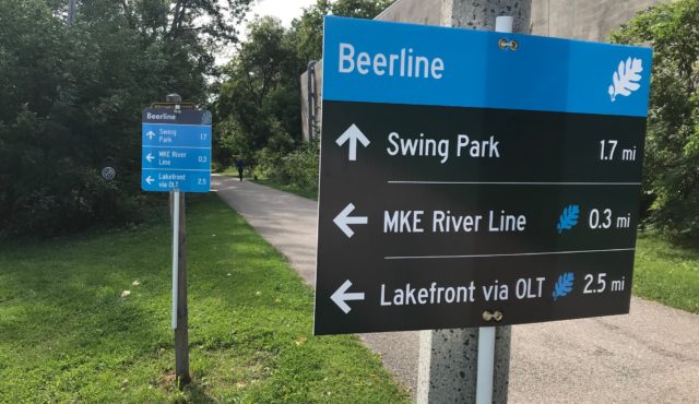
The sign designs and sign types comply with State and Federal requirements.

Toole Design refined the wayfinding sign designs after extensive outreach. We printed temporary signs and conducted intercept surveys at two locations in Milwaukee.