Housing affordability is a hot topic, but for a lot of households the problem isn’t just the rent or the mortgage. Transportation costs are another huge part of the financial burden on most Americans. Affordable housing in a place where there is no alternative to a personal vehicle has significant financial and social consequences, isolating people who cannot drive and creating friction for people who own a less reliable car. Each additional car a household needs is $500 to $1,000 a month that isn’t available for other expenses. Ultimately, this means a place that looks affordable on paper isn’t affordable in practice for many families.
How can developers, planners, and community members better understand the true cost of a proposed housing development? That’s the question our team set out to answer with the Mobility Choice Index (MCI) which measures the diversity of transportation options in a neighborhood.
Watch Transportation Data Scientist Hugh Kelley and former Project Planner Quinn Molloy walk through the Mobility Choice Index.
What is the MObility Choice Index (MCI)?
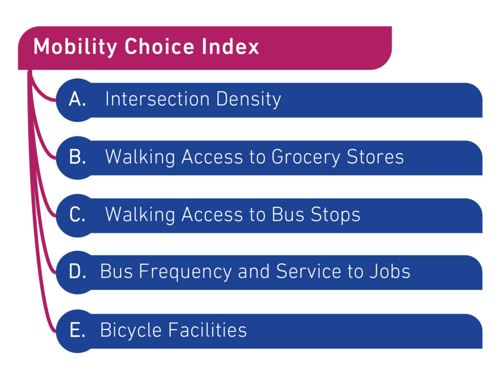
The MCI is a framework and an accompanying mapping tool that assesses transportation diversity parcel by parcel across a region. For any given piece of land, it asks a simple set of questions: Where can you walk from here? Is there useful bus service nearby? Are essential destinations—groceries, work, school—within reach for people who don’t have a car?
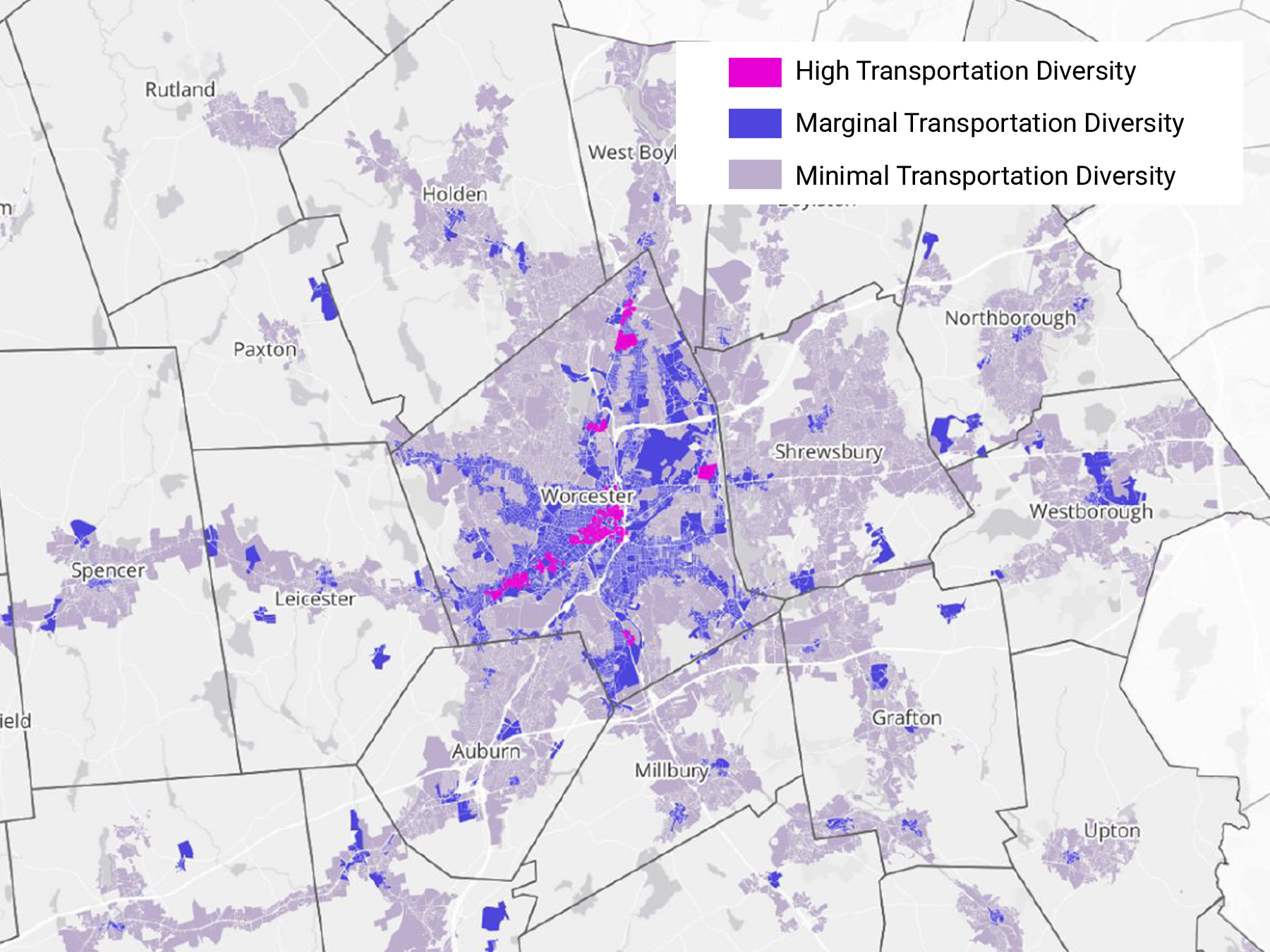
Unlike a single walkability score, the MCI doesn’t rank places or compare cities to each other. Instead, it diagnoses where a parcel falls on a gradient. At one end of the spectrum are places we call “vehicle locked,” where there’s no way to get around without a car. At the other end are places that are genuinely transportation diverse, meaning residents have a wide variety of options to choose from including walking, biking, transit, and vehicle-based modes like their own car and rideshare. Households choosing from a diverse range of mobility options consistently have lower household transportation costs, even if most houses still own a car!
Understanding this spectrum helps communities make more informed decisions: where to target new housing, where to invest in a sidewalk or a bus route, where development will burden residents with no alternative to driving. With that information, communities can steer growth toward the places where diverse transportation options already exist, or add mobility choices where they can have the most impact on long-term affordability.
The MCI was developed to be as accessible as possible. The data sets are publicly available, and the methodology is simple and easy to explain.
WHo IS IT FOR?
We developed the MCI while working with the Central Massachusetts Regional Planning Commission (CMRPC), alongside our project partner Community Scale, to calculate and visualize the range of transportation options in Worcester, Massachusetts, and the surrounding areas. We have since used the MCI framework for the Burlington, Vermont Comprehensive Plan, and continue to refine it for use in additional communities.
Check out a recent op-ed in the Commonwealth Beacon, co-authored by our Boston Office Director Jarred Johnson, for more on how the CMRPC project tackles housing and transportation concerns together.
The MCI is built primarily for the people making and informing land-use decisions: regional planning agencies, municipal staff, and developers. It gives them a way to understand patterns across an entire region, the tradeoffs of a selected site, and improvements or alternatives to consider while changes are still possible. The MCI isn’t meant to be the last word on where or whether to build. Rather, it can be the starting point for a better-informed conversation.
What are some use cases?
For regional and municipal planning agencies, the MCI feeds directly into development suitability analysis. Combined with other criteria, it helps identify which parcels are ready for higher-density housing today, and which would need transportation investment first to support it.
When municipalities are preparing an RFP for an affordable housing development on public land, the MCI supports affordability analysis to ensure the chosen site delivers long-term value to future residents. That data can also strengthen funding applications by demonstrating a resident-focused approach, considering resident expenses holistically. For comprehensive plans, which often address housing and transportation in separate chapters, the MCI can provide shared baseline data for both elements to ensure your plan’s housing and transportation policies support each other in service of affordability, climate, and accessibility goals.
Because the methodology is transparent and built on public data, clients aren’t limited to what we calculate for them. Once a community understands its own transit service, walkable areas, and daily destinations, many of the same questions the MCI asks can be applied internally as new sites come up for review.
Watch the video above for a walkthrough of the MCI with the Toole Design analysts who created it. And reach out to learn how we can help your community address housing and transportation needs—together.