Rush Line Transit Corridor Pre-Project Development Study
Ramsey County, MN
Project Summary
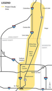 As part of the team developing plans for a new Bus Rapid Transit line in the greater Minneapolis area, we knew that connecting the corridor to the surrounding community was paramount. Toole Design pioneered a new GIS-based walk- and bike-shed transit access methodology to fully integrate active transportation into the alternatives analysis. Our new tool looks beyond the typical 1/4 mile walk and 3-mile bicycling concentric circles common in transit access analyses and incorporates network connectivity, topography and comfort for biking and walking. We’re pleased to continue work on this project as the team develops station area plans that include critical connections for walking and biking to transit.